
Climate Resiliency
on Block Island
Building BI's Coastal Resilience
Resources for Community Learning
In partnership with the Town’s Coastal Resilience Committee, we support community engagement and learning events to educate and foster conversation around building coastal resilience on Block Island. From formal presentations to community science projects, strengthening resilience to climate change is a shared responsibility. By partnering with experts both on and off the island, we can support informed decision-making and community-driven solutions. For key takeaways from a recent engagement event on August 5, 2025 click the button below.

Explore the key resources below to learn more about how our changing climate is impacting Block Island in various ways. There are additional resources in our Resource library
Focus Area: Corn Neck Road
Corn Neck Road is a particularly vulnerable part of the island, exposed to storm surge and flooding from the east, as well as adjacent ponds and marshes to the west. The Town has been working to strengthen the resilience of this critical roadway, which connects the north and south ends of Block Island. Explore videos and other resources related to Corn Neck Road projects here.

Solutions & Recommendations for Conceptual Designs
Click HERE to access the PDF of GZA's Presentation on Solutions and Recommendations for Conceptual Designs
GZA Presentation
GZA Presentation -Vulnerability Analysis and Survey Results- May 15, 2025

Mitigation Strategy and Conceptual Designs+
Mapping Tools
The following sites offer different ways to map climate impacts on Block Island and beyond. Explore the links below, as well as the toolbox to the right, to get a clearer picture of current risks and future conditions.
Sea Level Affecting Marshes Modeling (SLAMM)
Town of New Shoreham GIS Site (FEMA flood zones, plat, zoning, contour and soil maps)
To see a collection of climate mapping tools all on the same online map created just for Block Island, explore the Climate Resilience Map on The Town of New Shoreham's GIS Website

Click on the image above to access the toolbox for mapping climate impacts on Block Island
Protecting our Wetlands
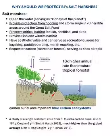
Explore the ways in which Block Island marshes and ponds are being monitored and tested with the links below.
BI Salt Marsh Monitoring by The Nature Conservancy
Water Quality Testing by the Committee for the Great Salt Pond:
Marsh Migration Mapping:



Water and Septic Concerns
The links below, from the Town of New Shoreham, URI, RIDEM and EPA, provide information and tools for maintaining and improving resilience of your underground systems.
Wastewater Management | New Shoreham, RI - Official Website
Block Island Map-Treatment-Zones-PDF
URI's Onsite Wastewater Resource Center: Community – Onsite Wastewater Resource Center
Septic & Onsite Wastewater Treatment Systems | Rhode Island Department of Environmental Management
EPA's Homebuyer's Brochure and Guide to Septic Systems
Saltwater Intrusion into Coastal Aquifers

Click on the image above to view Tom Boving (Professor of Env. Hydrogeology at URI) presentation on water tables on Block Island
Partnerships and Solutions


Click here to view Bryan Oakley's research on Bluff Erosion on Block Island
Ideas for the Beach House - collected from the public by the Coastal Resilience Committee members
Block Island is URI's Coastal Insitute's newest Climate Response Demonstration Site - with more information found at Climate Response Demonstration Sites – Coastal Institute
Block Island went through the Municipal Resilience Program's process and workshop to identify hazards and prioritize further action on building resilience. View the summary of findings by clicking here.
For more information and additional resources on building resilience and more, see our resource library.